
Rainforest Dam Hydrology - a travel case study

If you follow my socials you know that sometimes I like to drop all my responsibilities and unwind in far away (and not so far away) locals. This past trip I packed my little red hiking backpack and jumped on a redeye out to Puerto Rico! It was an impromptu trip to reset, refresh, and rewire. I brought my work laptop (of course I did) but the intent was to slow my brain down and give my deliberate neuro functions the chance to reboot.
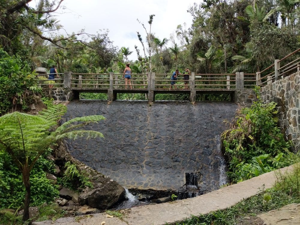
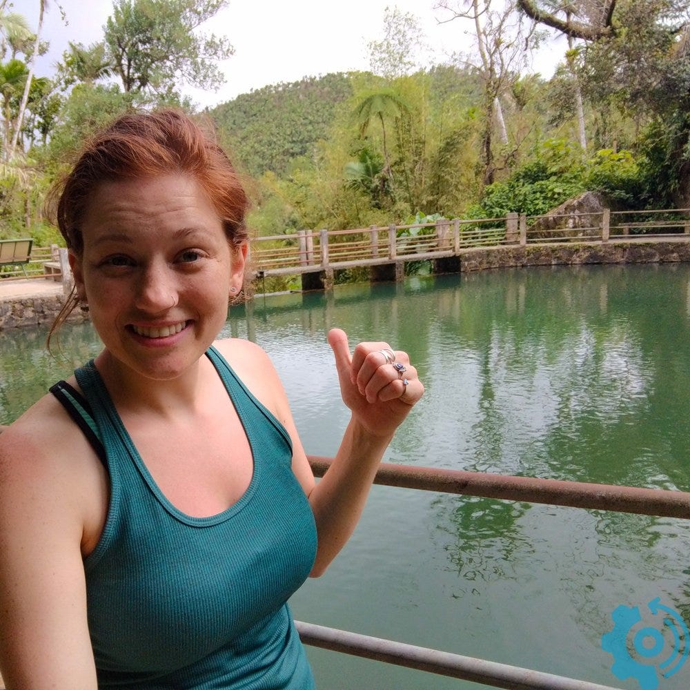
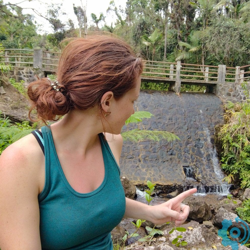
On my last day I went for a quick rainforest walk. I had intended to hike some of the trails but when you don't plan a trip you sometimes have to make sure you're back to the hostel's internet before conference calls with your #girlboss. Even with the time constraints, I knew that I just had to visit the watershed of the El Yunque Rainforest! I did my thesis in the rainforest and fell in love with the vibrant ecosystem and green green forest plants! I parked my rental car, strapped on my running shoes (regretting my decision not to pack sunscreen) and made for the trail. I'm pulling out my selfie stick and look up... dam! What's that doing here?!
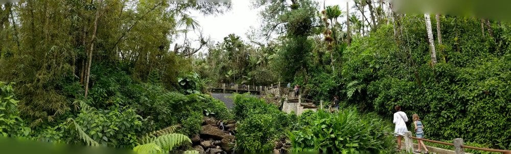
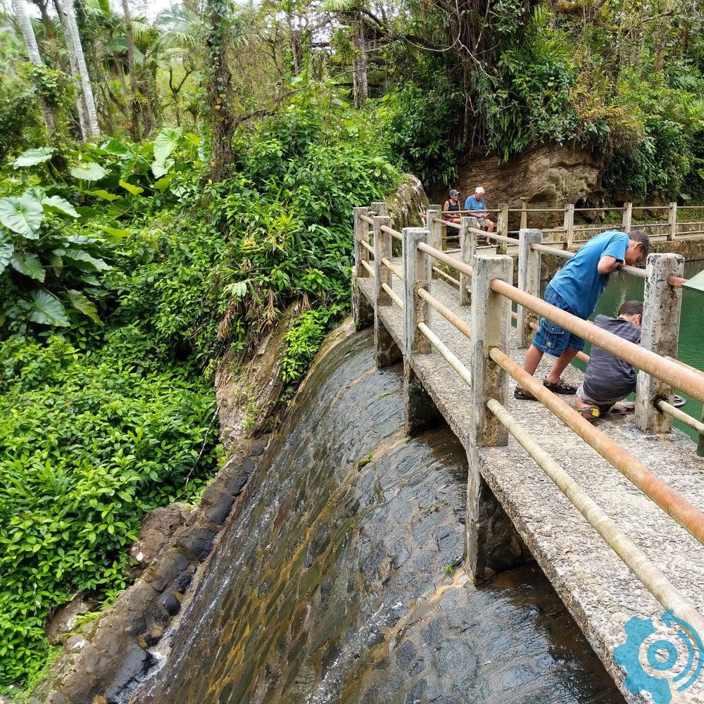
Here's the little trail up to the dam, an on-channel reservoir on the La Mina river. The watershed for La Mina covers 6.1% of the rainforest aka 2.7 square miles of this beautiful lush rainforest.
Watershed Taxonomy
Remember that a watershed (or drainage basin or catchment) is an area of land around a river, demarcated by high topography, where every drop of rain that falls within the watershed drains through a single outlet point (the river confluence to a larger river or into the ocean).

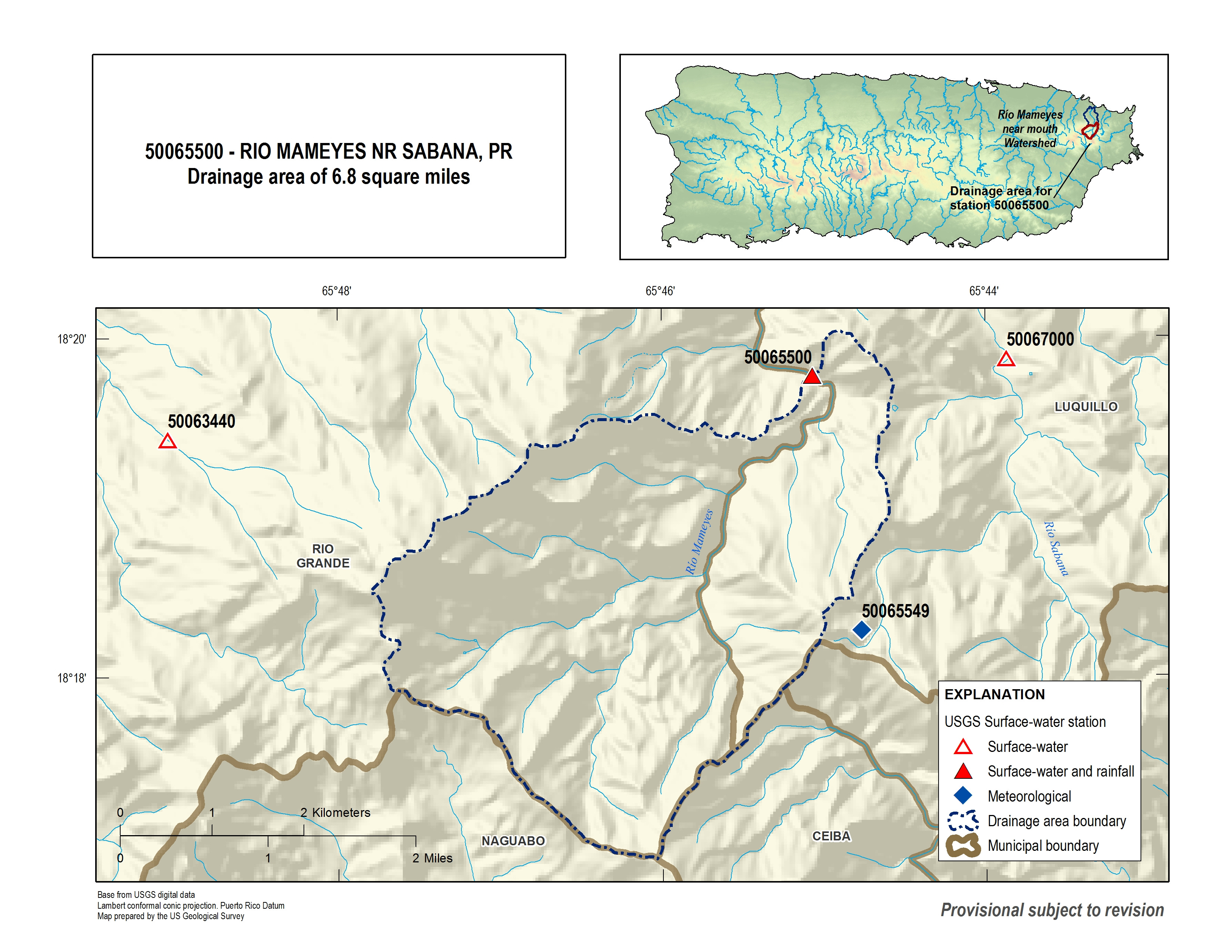
The USGS uses what they call HUC (hydrologic unit code) to designate all the watersheds in the U.S. (and you'll recall that Puerto Rico is a territory of the U.S. which is why you don't need a passport to visit!). If it's a little confusing why the codes are so long, there IS a method to the madness. 21 stands for the Caribbean Region. Then as you increase the resolution, more numbers are added to the back of the code. Puerto Rico is 2101000 and then there are 6 areas within the country.

So the La Mina watershed is within the HUC 21010005 and is a very tiny watershed. If you want to play around with HUC data, you can download GIS files for free from USGS! I've used them before during my graduate GIS class with a program called HEC HMS.

The La Mina outlet is right into the Mameyes river. So in otherwords, the La Mina watershed is a subwatershed (or subbasin) in the Mameyes watershed.
Dam Hydrology
In many watersheds that have seasonal rainfall (drought season and rainy season), a dam is an engineered solution for water storage and flood protection. During the rainy season, when the rivers swell with water, you can capture the water within the reservoir. This prevents flooding downstream as you route the water into a safe location. You can also manage the storage during the wet season so that instead of having peak flooding that is susceptible to weather patterns, you consistently release an amount of water down the river. This means less erosion from flash flooding and safer communities downstream. You can also put hydropower on them and produce clean energy.
Then in the dry season, you have a body of water stored up for irrigation or drinking water use.
Dam Components
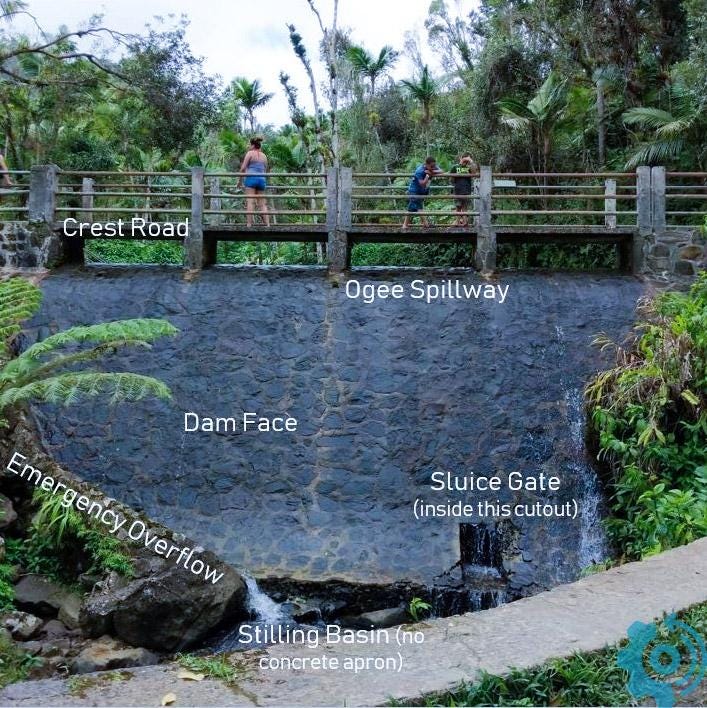
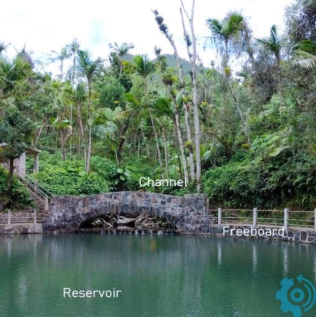
Our dam in Puerto Rico has all the components of a modern dam. Notice in the graphic below that this is a gravity dam where maximum water level (MWL or sometimes called Maximum Water Surface Elevation MWSE) is designated near the crest. Normal operating conditions are also shown. We'll get into the hydrological management of dams here in a second.

Cross section of a gravity dam. Our dam in Puerto Rico has two main differences: there is no gallery (hallway to walk through the dam) and the spillway is on the crest (because it’s an ogee dam).
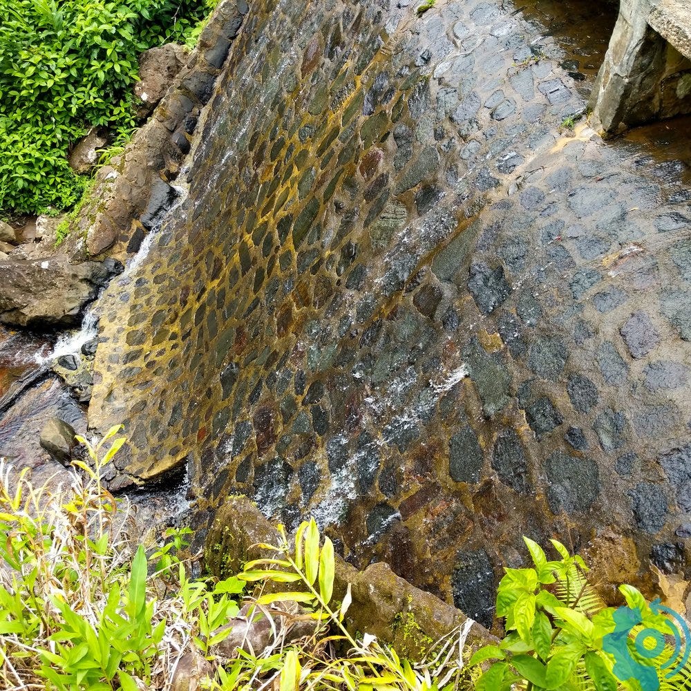
An ogee is a type of chute spillway named for its design around an ogee curve (a soft s-shaped curve which you might not have studied in math class… or at least I don’t remember studying it).
On Yt I outline other technical components of our dam.
Hydrology Monitoring
Here we have a small lake where water is being held at the top of the crest. So any additional water that drains in from the watershed will flow right over the ogee spillway. This particular lake used to be an 18 FT deep pool. I can see why they don't let people hang out near the spillway in a forest that may start raining at any moment but.... how cool would that be to go swimming here??
All the major rivers in the U.S. have river gauges which push realtime information out to the web through the National Water Information System (NWIS) interface. If you want to see the gauge for the Mameyes river, click here. I think the La Mina river might be a bit small to have its own gauge.
You can see they collect river level and meteorological information. There are piezometers which collect groundwater data too!
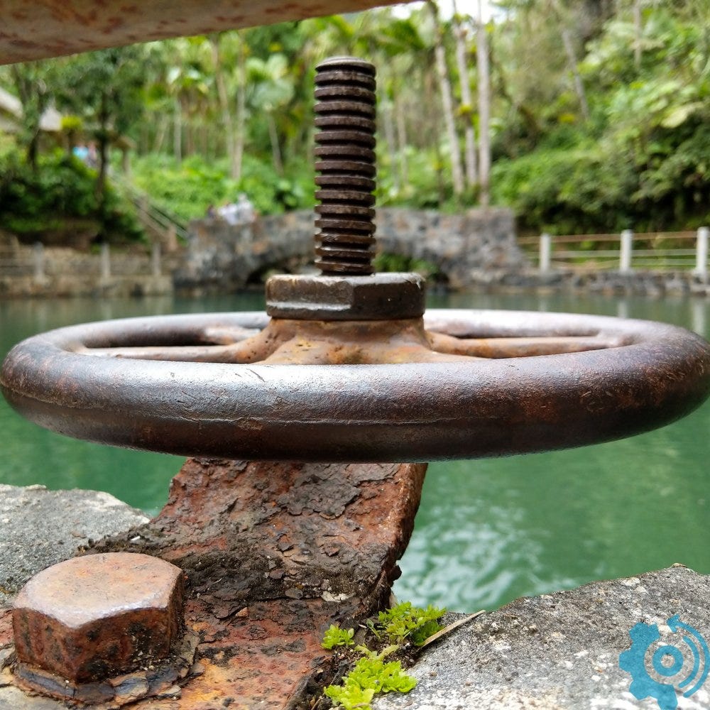
I was just at the NWIS website earlier this morning to look up how much water was in a river at one of my project sites. We're currently drilling on the dam spillway (right beneath the ogee on a concrete apron) and I wanted to make sure that the water level hadn't risen with a few sprinkles this past week. If the water gets too high, wind will push it over the top. As project manager, I want to make sure that my folks are safe from water coming over the top and drenching them. Slips trips and falls y'all! Luckily, in the watershed where my project is located, the water level is very slow to rise. It takes a lot of rainfall to fill that big of a lake!
Water Management of Reservoirs
The reservoir is managed at different levels for different times of the year. The graphic below shows the four main storage zones of the reservoir.
In the bottom there is a dead zone which fills with sediment brought in by the river. Pump intakes and spillways are always designed above this zone.
The inactive zone is a buffer between the dead zone and usually has pretty turbid water. This can be used in the event of a major emergency but requires extra filtration.
The active zone is your main supply of water for recreation, irrigation, drinking, hydropower, and environmental flows.
The flood control zone is for capturing excess rain during months of storms.
There are no physical barriers which separate these zones. It's all one pool of water but when we talk about water storage, we think about them in terms of water elevation and what that elevation means for current needs of the reservoir. A dead zone may have more sediment than it was designed for if there's been a lot of erosion upstream; it may have less sediment if it has recently been dredged. These zones are general ideas rather than exact elevations.

When we manage the reservoir pool, we take into account additional political or socioeconomic parameters. For example, in the springtime, the water management utility might decide to reduce the reservoir lower than normal operating levels in expectation of lots of rain. In the summer, even if the water levels are up near the MWL, they may decide to keep the reservoir high for seasonal drought purposes.
I did a project for a grad school class once where we looked at the Klamath dams. We looked at all the different stakeholders and tried to predict the future of the dam in congruence with the endangered species act, operational needs, etc. The dam is now... being removed.
Environmental Impacts
My coworkers do three types of dam projects: rehabilitation of old dams (my project in Oklahoma), construction of an off-channel reservoir (my project in Texas), and dam removal. As much as there is a great benefit to controlling and diverting flows with dams, there can be an environmental toll that outweighs to benefit of the dam. Some dams just aren't being used anymore for hydropower and it doesn't make sense to keep up the maintenance of the dam. Some of the dams are failing infrastructure. And some have such huge environmental impacts that it negates the value of the dams.
Such as what? Well dams can certainly get in the way of fish passages such as the case of the Klamath dams. Here's a bit about how floods, which are generally seen as natural disasters, actually have environmental benefits.
River and floodplain ecosystems are closely adapted to the annual cycle of flooding and drying. Many species depend on seasonal droughts or pulses of nutrients or water to give the signals to start reproduction, hatching, migration or other important lifecycle stages. Annual floods replenish wetlands not only with water but also with nutrients, while flooded manure from both domestic and wild animals on the floodplain enriches the river. Floods sweep fish eggs and fry into floodplain backwaters and lakes where they hatch and grow before joining the river again after the next annual floods. Adult fish and other aquatic animals such as turtles also follow the flood to take advantage of the new food sources offered in the submerged shrubs and woods.
In some cases, it still makes sense to have a dam for all the other beneficial reasons. So instead, in our sustainable world, many regulating agencies mandate environmental flows. That is, a certain amount of water must always be released through the dam. If you've ever taken a walk downstream of Longhorn Dam in Austin (it holds the lake downtown that we Austinites love), you can see that there's a little 2-ft diameter hole in one of the gates. This is the outlet point for the minimum flows needed to sustain the ecosystem. I really like this little infographic on environmental flows. Check it out!
I have yet to work on a dam removal project (these are happening much more in the Pacific Northwest than in Texas), but if any of my coworkers need help... y'all know where to find me!
Reading: Mistborn #1. Just finished it and I'm obsessed. Why did I put this one off for so long??
Listening: Eleanor Oliphant is Completely Fine by Gail Honeyman. The audiobook was SO good with the accents. Also, the book was crazy good. I like that the author gives you enough info that you can sort of guess the trauma from Eleanor's past. And also how quirky Eleanor is! Honeyman did a fantastic job in developing the characters. I can't wait to see who plays Raymond in the movie version!
Working: Putting together applications for an international internship program with my company. It's a very cool program where they promote cross-country and cross-discipline learning for employees under 5 years of experience. 6 months in a different country working on iconic engineering projects? Heck yes!